LaCava Rare Books
1892 Plat Book of Bureau County, Illinois Princeton Spring Valley Atlas Maps
1892 Plat Book of Bureau County, Illinois Princeton Spring Valley Atlas Maps
Couldn't load pickup availability
Plat Book of Bureau County, Illinois.
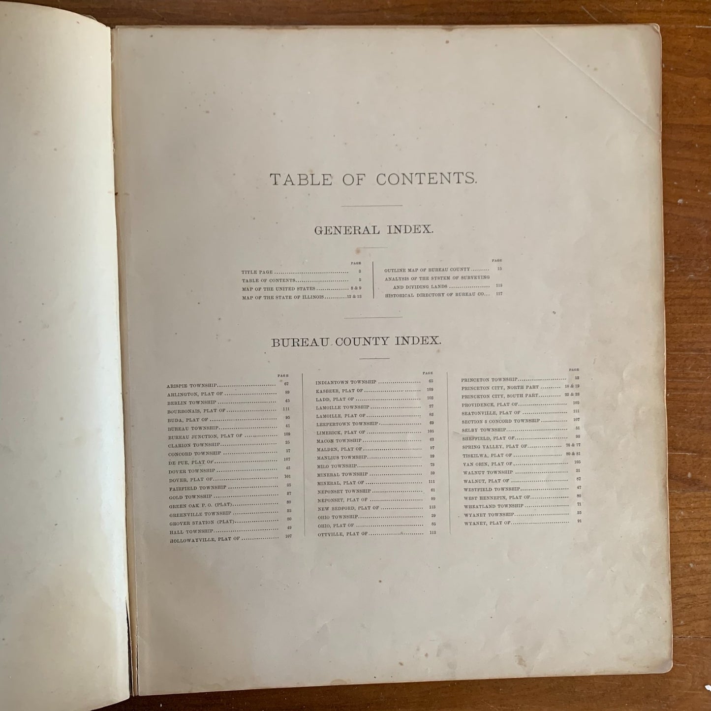
Chicago: Geo. A. Ogle & Co., 415 & 417 Dearborn Street, 1892. Engraved by Balliet & Volk; printed by F. Bourquin, Philadelphia. Large folio, approximately 15 x 18.5 inches. Original maroon pebble-grain cloth boards with darker maroon leather spine and corner tips, blind-stamped decorative borders and silver-gilt title to front cover. Approximately 117 pages, including the title page, indexes, two-page Gray's New Map of the United States (with inset of Alaska), two-page map of Illinois with Cook County inset, color outline map of Bureau County, color plat maps of every township in the county (Fairfield, Greenville, Walnut, Ohio, Lamoille, Clarion, Manlius, Bureau, Dover, Berlin, Westfield, Mineral, Concord, Wyanet, Princeton, Selby, Hall, Neponset, Macon, Indiantown, Arispie, Leepertown, Milo, Wheatland, and others) with thousands of named landowners, plats of the cities and villages of Princeton (north and south parts), Spring Valley, Tiskilwa, Sheffield, Buda, Wyanet, Walnut, Ohio, Lamoille, Malden, Dover, Neponset, New Bedford, De Pue, Ladd, Limerick, Bourbonais, Bureau Junction, Hollowayville, Seatonville, Ottville, Van Orin, Kasbeer, Mineral, Arlington, Providence, Green Oak, Grover Station, and West Hennepin, an Analysis of the System of United States Land Surveys, and a Historical Directory of Bureau County. Condition: covers heavily worn and rubbed with significant losses to leather at corners and spine extremities; cord/string spine binding frayed and disintegrating with portions detached; binding loose throughout, holding by remaining cords only; outline map of Bureau County (page 15) has a red marker line drawn across the central portion of the map, crossing Bureau, Dover, Selby, and Hall townships; water staining to outer edges of front matter and some plates; scattered foxing and toning; plat maps generally bright with strong original hand-coloring. Plat content largely good.
Geo. A. Ogle & Co. of Chicago, was one of the most prolific and respected publishers of American county atlases in the late 19th and early 20th centuries. The plat maps name thousands of individual landowners across every township and section, providing an irreplaceable snapshot of Bureau County land tenure in 1892, on the eve of the Columbian Exposition and at the height of the Gilded Age. This atlas is foundational reference material for genealogists tracing Swedish, German, Irish, and Yankee farming families across Princeton, Sheffield, Buda, Tiskilwa, Wyanet, Walnut, LaMoille, Ohio, Spring Valley, and the surrounding communities. Of particular note are the detailed plats of Spring Valley, then a rapidly growing coal-mining boomtown along the Illinois River, and Princeton, the county seat with deep abolitionist roots tied to Owen Lovejoy and the Underground Railroad.
Satisfaction guaranteed or you can send it back!
Satisfaction guaranteed or you can send it back!
Share